“The past is still, for us, a place that is not safely
settled.”
Michael Ondaatje

There is now a long,
visible and well researched history of the relationship between archaeology and
photography. Mostly it is framed by concepts of power, so the first studios in
Cairo and Constantinople that sold albums of images of pyramids and temples
understood the connection between the places that European societies claimed to
have come from and the places they now claimed as their own. The history of
Postcards and archaeology follows the same course, with crucial derivations. The
most important happened when institutions including state run and private
museums took control of the images. All their archaeological postcards are
political. The customer who bought a postcard from the Acropolis Museum in
Athens and the person who received it were being offered a state sanctioned
view of Greece’s long history; not just a statue but a reminder of Western
Civilization’s origins, and its debts.

Archaeological
photographs used to depend on two simple definitions. One was that the object
pictured was dug up, or somehow recovered. The other was that it was old,
preferably pre-historic, or before the written word. So long as one of these
could be applied then the image at hand was archaeological. That has changed.
Archaeology today has to be neither dug up nor particularly old. Even the most
encompassing definition, that the item in question is tangible doesn’t matter
anymore. Some media archaeologists live in a world of pure theory. Contemporary
definitions still ride on an old motif however; that image of the archaeologist
stumbling across some lost city in the jungle, or wiping the dust from a wall
of ancient glyphs, but modern archaeologists have turned out to be a bunch of
spoilsports. Not only has Stonehenge nothing to do with druidism, all the
evidence unearthed recently suggests it was the winter solstice that drew the
crowds.

Chanctonbury Ring is a
famous Iron Age fort in Sussex, hidden behind the copse on the hilltop. There
are dozens of hill forts across England, built in the centuries before the
Romans arrived, when available technology meant the hill was the easiest
position to defend and to seek protection. With this image we see the hill
fort’s position within the landscape, from the point of view of either an attacker
or someone who would find sanctuary within it. Just how closely it resembles
the landscape of the Iron Age is uncertain. There appears to be a large house
in the centre just below the ring. Apart from that, the vegetation may be
mostly native but we know that one impact of empire on the nation itself was a
vast number of introduced plant species. During the late 18th and
early 19th century it became fashionable to cultivate a kind of
wilderness in Sussex, so areas would be set aside and allowed to grow into what
was imagined an ancestral landscape. This would never have been allowed during
the Iron Age. One thing we have learned about the Neolithic British is how
enthusiastic they were for land clearance.

In World War 1 Osbert Crawford
was attached to a survey corps, reading reconnaissance photographs of the
trenches taken from aeroplanes. As an archaeologist in the 1920s he took the
same idea, returned to the skies and turned his cameras on to the English
landscape. From the air he was able to identify the prehistoric avenue
connecting Stonehenge to the Avon River, which apart from everything else,
expanded Stonehenge’s place in the landscape. Around the same time, the aerial
photographic company, Aerofilms, was established. Aerofilms turned to
publishing postcards, with archaeological sites one of the company’s most
popular subjects. It isn’t hard to see why. Viewed from the air, the
perspective of sites like Maiden Castle was literally transformed. It was more
than a matter of reading the shape of the site from a new angle; it was also
about reading the site’s context within the landscape. Aerial photography was
the most important innovation in archaeology before the advent of LIDAR and its
importance was transmitted through postcards.

Reading books like Bones by Elaine DeLay, you begin to
think there must be no more miserable job on Earth than to be an archaeologist
in the Americas. Fights between the traditionalists and revisionists are
preliminary bouts compared to what happens once First Nations communities get
involved, and it doesn’t require paranoia to detect the hidden hand of
government agencies behind some of the biggest disputes. In 1998 the archaeologist
Brian Billman said that his research into the Anasazi culture in Mesa Verde
indicated an outbreak of cannibalism around the period 1150 to 1250 CE. For
decades archaeologists had been seeking answers as to how and why the Anasazi
culture collapsed so dramatically during that time. Cannibalism, Billman
argued, was a symptom, not a cause, which is usually reckoned to be severe
droughts brought on by some localized form of climate change, but it was not
news that local indigenous people wanted to hear. A well-worn conflict
re-emerged, between archaeologists who believed nothing should be immune to
inquiry and First Nations people who responded that aspects of culture were
private. Well, those were the basic position, minus the truckload of nuances usually
dumped on these situations. For some First Nations people, a postcard view like
this is problematic. It brings in tourists and relic hunters when what they
would rather have is for history to follow its natural course and these ruins
be allowed to slowly return to dust.

Call that attitude
wilful intransigence if you want, but when you see photos like this, it makes
sense. For a long time one of the drawcards to Teotihuacan and other Aztec
sites was their association with human sacrifice. The architecture became mere
set design. The Aztec Empire existed for a brief time before the Spanish
conquest. Before then it was a multi-lingual and fluid confederation of
cultures. The first reports of Aztec ceremonies came from the Spanish; to which
details were later added by people who may have technically been Aztec but
weren’t necessarily loyal to an idea. The spectators seen in the background
would have paid to see an ‘authentic traditional Aztec’ performance but since
none of the primary sources were trustworthy it was more accurately a
recreation of European ideas of what a human sacrifice should look like – think
Maureen O’Sullivan tied to a pole while Victor Mature struggles vainly with his
captors. Authenticity is a word
archaeologists and historians try to avoid. Inevitably it is used to mean
something directly opposite to the dictionary definition.

The question of whether
archaeology is an art or a science still raises its fuzzy little head though
increasingly the revelations provided by technology such as LIDAR push it
towards the latter. A good archaeologist need not know much about oxygen isotope
analysis but he or she ought to know someone who does. It wasn’t always the
case. Before archaeology there were antiquarians and orientalists, who travelled
out to sites like Persepolis, sketched the monuments, collected artifacts and
proposed theories. Archaeology was an art because it was romantic. With
respectability however came responsibility and by the turn of last century very
specific skills were required. Being able to read cuneiform was pretty much
useless for everything in this world except an excavation at Persepolis and
there it was essential. This image you feel tries to evoke that era when
travellers might stumble upon some ruined city on the plain then gaze upon its
monuments with a philosophical terror.

A seemingly innocuous
image of some ancient foundations but what it presents is a history of
archaeology C1860s to 1940s, and then what was to follow. Not all middle eastern
archaeology in the 19th century focused on the Bible but so much of
it did that it is hard to tell these days whether we are dealing with scholars
or fanatics. Take this scrap of wall and the bare framework of a hole. During
the 1850s and 60s Orientalists were busy arguing over the site of the hill of
Calvary when a number of tombs, including this one were excavated. Suddenly the
world had a tomb just below the place then known as Skull Hill, and this
according to some was close enough to the biblical account to suffice. There
are dozens of very logical reasons why this cannot be the tomb Jesus was placed
after being taken down from the cross, but that hasn’t stopped people visiting
it as part of their crucifixion tour. Back around the 1940s when this photo was
taken the politics surrounding the site were almost non-existent, or at least
treated as such. Today while Jews and Muslims fight their battles, lesser known
but often violent episodes break out here between Greek, Coptic, Roman,
Protestant and other branches of the Christian faith. It no longer matters
whether or not this is the actual site. What does is that some people badly
feel the need for one.

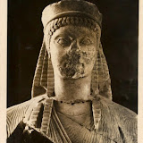
For a while there, we
in the west could look upon archaeology’s tainted past with righteous shame.
Museums throughout Europe were full of plunder that rightfully should be returned.
The arguments were complex; there’d be no point in having them otherwise. How,
for sinister example, could the British Museum and various medical colleges
justify all those crates of remains of indigenous people, shipped out from
Australia in the 19th century only to be dumped in the cellars and
left unopened? Well it couldn’t, and so some were repatriated and everyone put
on happy faces. But what about the Elgin Marbles? That was different. Athens
was horribly polluted and returning them (right thing, of course) could see
these prized sculptures crumble to dust like Dracula in the sunlight, (so wrong
thing). The argument changed in 2015, when ISIS took control of Palmyra in
Syria and began looting and destroying it. Palmyra represented the very
foundations of Western Civilization; from its origins in the Bronze Age to
becoming one of the centres of Eastern Greek culture, to one of the great Roman
cities and then a major point on the Silk Road. The tragedy of Palmyra’s
destruction was partly ameliorated by all that 19th century plunder
on our part. Suddenly it looked like foresight that our museums, archaeologists
and sundry scholars had been practising all along. Thank God we got all that
stuff out in time. The cases for and against repatriation have ceased for the
time being, and it is unlikely we will hear them for a long time, at least so
far as the Middle East and Africa are concerned. In the meantime, London
dealers will continue to keep the market in looted antiquities alive.
 |
| GODS GRAVES AND SCHOLARS |


