Panoramic
postcards of Egypt by Lehnert & Landrock
“Give
me my robe, put on my crown; I have immortal longings in me.”
Shakespeare: Antony and Cleopatra

When Rudolph Lehnert and Ernest Landrock
moved their photographic studio from Tunis to Cairo in 1924 they were
announcing to anyone listening that Egypt’s capital was also the cultural
capital of the Middle East. Not that they decided this: the year before, Howard
Carter and his team had broken into Tutankhamen’s tomb and Ancient Egypt had
once again become the most exciting idea on the planet. In far off Hastings,
builders excavating a basement discovered some odd glyphs in a dingy tunnel and
for a moment the theory that ancient Egyptians or Phoenicians had visited the
place was kicked around. The place called Ancient Egypt, or at least the idea
of it, had seldom been out of fashion’s eye in the last fifty years but now it
was back centre stage. There were at least half a dozen other companies in
Cairo producing real photo postcards for the European market but Lehnert &
Landrock would become the best known.

Lehnert, the photographer, had certainly
worked in Egypt before the company opened shop there but once it did, business
flourished. We can think of its halcyon years as coming between 1924 and the
beginning of the war. Although a great enthusiasm among the British for German
product seems unpatriotic, even love of country has its limits. There was a
booming international market for shots of L&L’s most renowned genre: nude
Bedouin women, and the British were driving demand as much as anyone else. But
anyway, we’re not here to talk about that, or even more dubious genres the
company marketed but rather the flip side; Egypt as a phenomenon of cultural
sophistication.

From the beginning, postcards were the
familiar size by which we know them, approximately 3½ x 6 inches, because they
fitted the standard envelopes for informal correspondence. In some countries
the laws sounded specific; the post card had to be ‘no more than’ or ‘less
than’ or ‘at least’, but this only meant that anything that fitted within the
required dimensions was legitimate. Publishers produced midget size and giant
size postcards but the most common irregular format was the bookmark size, and
though bookmarks of stage stars were popular, landscapes and street views have
become the most enduring, especially the bookmark postcards from Cairo that
Lehnert and Landrock produced.
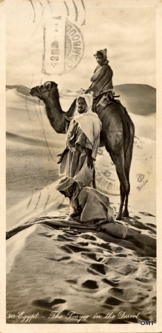
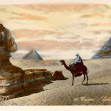
One of the company’s achievements was that
it managed to make Egypt look how everyone imagined it to be; a land still
touched by its ancient past, with oases of palm trees providing shade from
which to contemplate the pyramids, maze-like souks, the stalls piled high with
ornate rugs and silverware, and watched over by hawk-eyed Muslims. One hundred
years ago, the abiding image of Muslims was of devout, silent and impassive
people. Of course, not long before in the Sudan and southern parts of Egypt
Muslims were fanatics who needed to be suppressed with violence if necessary,
but that was now the past. In popular culture the siege of Khartoum was just
another heroic chapter in the history of the British Empire.

From 1882 until 1922 Egypt was officially a
British protectorate (and less officially into the 1950s). This explains why
Cairo, a city inhabited by Egyptians since 969 CE would have a ‘native quarter’. This was both a ghetto and a slum –
neither being necessarily the same thing – separate from areas occupied by
Europeans, Armenians, Alexandrine Greeks, Jews and Ottoman Turks. Egypt at this
time, well, until 1914, was also a khedivate of the Ottoman Empire. The
condition for Egyptians was something like being the child of two parents whose
contempt for each other was outmatched by that for their offspring. Said
children are usually destined for a miserable adulthood.

Cleopatra, Khartoum, The Greatest Story Ever Told: in the
1960s Egypt became the canvas for epic visions, though ‘bombastic’ might be a
better adjective. There’s a suspicion, and maybe nothing more, that one
influence was these panoramic views; well they share the same format and there
is something about the panorama, no matter how small, that speaks of the vast –
in time as well as space. To create this image the studio simply took a
standard format negative and cropped what wasn’t needed. There isn’t the
distortion a genuine panoramic camera would produce. Still, removing whatever
was extraneous and leaving the palms, the camel, the cart and the porter
suggests a scene that could take place anytime in the last 200 years.
Interestingly this is titled Kasr el Nil
Bridge but it may be the one it replaced in 1931, the Kobri el Gezira. Photos of that one have the palms but they are
absent in views of the later bridge.

The Orientalist argument says that these
views tell us more about the consumers than the place, which should be beyond
dispute by now, but what after all do they tell us about Cairo? Where, for one
thing, are the crowds? Today the city is so densely packed that a view like
this one seems impossible even at unlikely hours. Was it really so magically
empty in the 1920s? No. As far back at the 1500s, when Europeans began arguing
over the biggest, the richest and the most powerful cities in the world, three
were inevitably ignored: Peking, Bombay and Cairo. As engines of civilization
they were derided, despite the monumental evidence opposing that, and despite
the popularity of Ancient Egypt stemming from the great desire of London,
Paris, Rome etc to be seen as the inevitable heir to its culture. So no; this
is not the vast, hectic and noisy city tourists encountered but somewhere ancient
and austere: the place they came to find.
 |
| ANCIENT HISTORY |


